Ellingwood
Point and Blanca Peak
Colorado 14er
14,042 and 14,345
Colorado 14er
14,042 and 14,345
|
|
Ellingwood
Point and Blanca Peak Colorado 14er 14,042 and 14,345 |
|||||||
|
||||||||
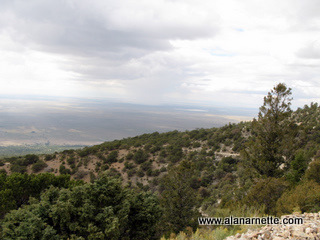
You know it is bad when climbers speak more about a road than of the mountain. The 4WD "road" to Lake Como easily deserves such mention. I wanted to bag three 14ers in one trip to avoid another trip up the road so in mid September 2009, I set my sights on Ellingwood Point, Blanca Peak and Little Bear Peak all in Colorado's southern range - the Sangre de Cristo. This is a trip report of mixed results. I climbed the Little Bear - Blanca Traverse starting at the West Ridge on Little Bear in June 2013. See this report. Click on any picture to enlarge it. Little Bear is known as one of the most difficult 14ers due to a dangerous gully a few hundred feet below the summit. Rock fall is common and it has old fixed ropes due to the steep angle. That was my first objective as I took my Jeep Wrangler up the Lake Como road. The dirt road leaves the expansive San Luis Valley off CO 150. It is an interesting view with the Blanca Massif group rising almost a mile above the valley floor. I found the lower part of the road equal or less than recent drives to Sneffels and the Lead King Basin for Snowmass. However, I was humbled at 4.5 miles when my jeep bottomed out on a hairpin turn involving four foot high boulders. So with a nice parking spot available off to the side, I parked the jeep and hoisted my pack to walk the remaining miles to the lake. All in all, it was not as bad as I had expected. 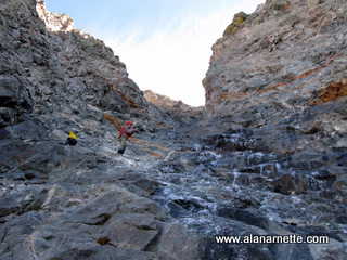
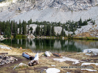
Lake Como sits in a nice flat area to the north of Little Bear and west of my other two objectives. I pitched my tent by the lake, had dinner, met some new friends and crawled into my bag. Little Bear's standard route starts with a short scree climb to a saddle and then crosses the southwest face to the hourglass gully. This is where the real climbing starts. I was climbing with a young couple I had met at camp, Tyler and Sabrina, as we began the gully climb. To cut to the chase, the gully was filled with veriglass or a thin layer of clear ice on rock. Tyler and I climbed to about 13,700' before we deemed it too dangerous to continue. The center was frozen over some running water but veriglass covered everything else. We could find palm sized spots of clear rock surrounded by clear ice so upclimbing was doable. However we became concerned about the down climb and tested a few pitches before calling it. No regrets, I will return on a dark winter day or a bright summer one but climbing on smooth ice at a 45 degree angle in a 300' gully with no protection was dumb. Defeated by the bear, I returned to camp awaiting the arrival of my partner, Robert, for our climb of Ellingwood and Blanca. That afternoon it hailed about 2 inches at our campsite but Robert, walking up the valley floor, just experienced the Lake Como road in it's dry and hot full fury. 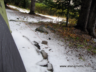
We decided to make a late start to let the fresh stuff melt from Blanca. Climbers who had turned around the previous day reported slick conditions. So we left camp about 8:00 AM enjoying a leisurely breakfast and sleep-in. The initial route follows a series of small alpine lakes and takes you to a series of short ledges that proved to be more annoyingly long than anything else. 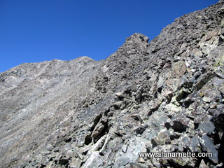
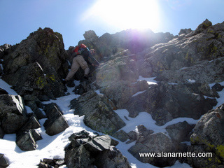
However we soon found ourselves in the wide basin below Ellingwood's south face and Blanca's northwest ridge. There was nothing but talus in all directions. The route description calls for locating a mine hole in Ellingwood's face and traversing below it. However, Robert and I spotted climbers well above the opening and on the ridge climbing steadily towards Ellingwood's summit. And with that as a milestone we climbed higher. There are so many trails (I use the term loosely) on the face that you could choose any of many routes but basically they all take you to the ridge and after a few minutes we were there. The climb to the summit was easy and we enjoyed the impressive views of the turning aspens in the valley below as we contemplated the traverse to Blanca. 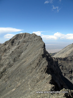
What is interesting about this climb is how much harder it looks than it really is. This was a common theme in many of the trip reports I had read in preparation. The connecting ridge was rated as class 2 if you choose the correct line. So with that in mind we left Ellingwood's summit and returned to the saddle between the two peaks. However, Blanca's summit ridge looked imposing, steep and more than class 2 from every angle. 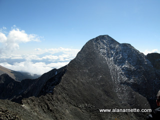
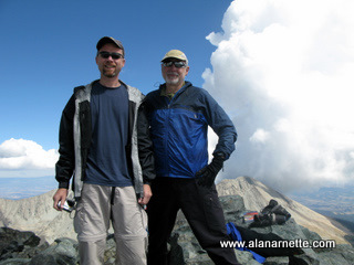
We continued the traverse with Robert taking a lower line and I, enjoying the ridge climbing, struck to the ridge or just below to take in the the class 3 stuff. It was not too long that we found ourselves approaching Blanca's true summit with patches of established snow on the rocks. A few scrambles later we were on the summit enjoying more awesome views. The return to camp was the usual ankle and knee bending challenge along the talus and scree but we made it safely and enjoyed another night in camp. A family of deer joined us for dinner. A nice way to end a fun day. OK, Little Bear stopped me but even with full winter gear, I would have probably made the same decision. Conditions were about as dangerous as I have experienced in Colorado. 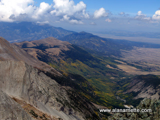
If it had not been for the ridge climb to Blanca; Ellingwood and Blanca, would have ranked as one of the less enjoyable of the 50+ 14ers I have climbed. Basically it was all talus scrambling with little feeling of progress or satisfaction. However, as is usually the case, the view from the summit makes all the misery and boredom worthwhile. But then again that road ...
|
|