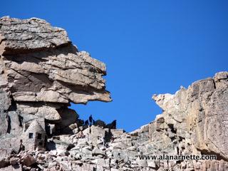
Keyhole
Route
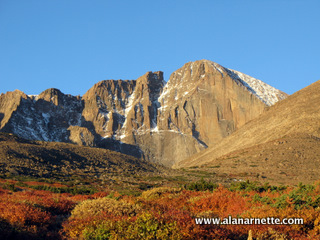
Longs Peak
14,259 feet, 4346 meter
Longs Peak
14,259 feet, 4346 meter
|
|
Keyhole
Route Longs Peak 14,259 feet, 4346 meter |
|||||||
|
||||||||
|
I have summited Longs 43 times, most recently in July 2016. I use it for training for climbs such as Everest and K2. I've climbed up via the Keyhole route and descended using the Loft route. It was spring weather with winter climbing conditions above 12,000'. Please see this video of the climb. click on any picture to enlarge it. There are guide services that do Longs but unless you want to do the Diamond (technical rock climbing), I don't think you need them. Almost anyone can summit Longs in good weather and with proper preparation but again, Longs can take lives for the unprepared or due to accidents. The park service recently put this sign up at the boulder field: 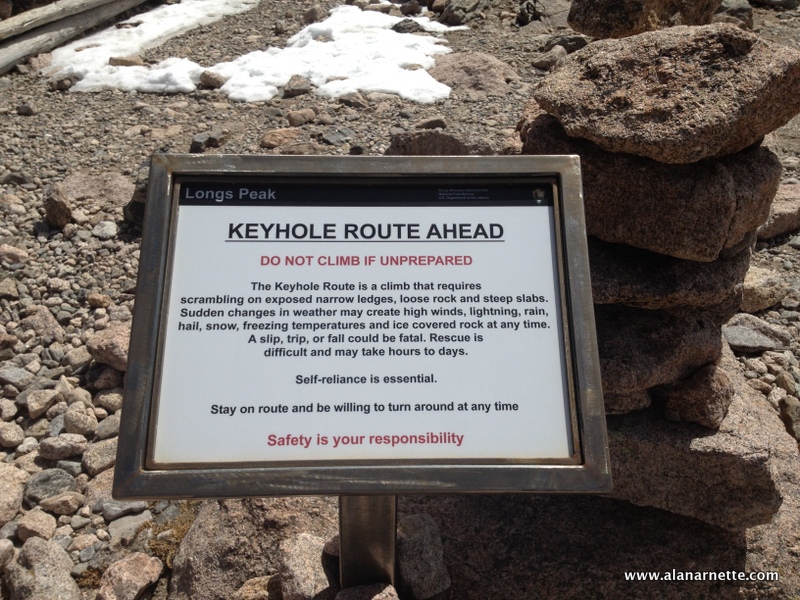
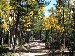
There are three basic parts to the day: 1) trailhead to the Keyhole, 2) Keyhole to summit and 3) back down. The first part is simple enough: beautiful trail through the pine forest rising above the tree line at 10,500'. You will see the trail going left to right above the treeline. It should take between 45 minutes and 1.5 hours to reach tree line. Above
tree line, if it is windy, this will be your first test of Longs. After following
the trail towards Chasm Lake, you will veer right and follow lazy switchbacks for
a while and go around Mt. Lady Washington in a big U. Some people follow the trail
straight towards Long's and Chasm Lake thinking that is the Keyhole route - big
mistake. At the most Northern part of the trail, Granite Pass (12,080'), there are great
views of where you came up and where you need to go. It is still about an hour
or 1.5 hours from here to the next goal: The Boulder
Field. At this point most people have spent about 3 to 4 hours, maybe less. This is a
good time to take a short break with food and more water - especially if it is a
warm day. With the low humidity in Colorado (less than 10% on a summer day) you
do not notice how much water you lose through perspiration and it must be replaced
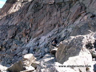
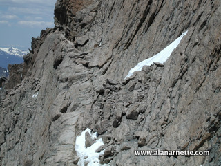
to avoid dehydration. It can be extremely windy at this point but normally dies down considerably a few hundred yards along the Ledges. If the clouds are building or it is past noon, consider carefully the lightening danger and turn back if there is any concern. You do not want to be above this point (or even treeline) in a thunderstorm. The trail is marked with red and yellow "bulls-eye" targets painted on the rocks. Watch carefully because when you think you need to go up, you go down a couple hundred feet and then back up again. It can be confusing. On a busy summer day, there will be people all over this steep and rocky area. If there is snow be especially careful since it is a sharp 2,000' drop to the valley below. There are a couple of moves over large smooth rocks that give some people pause.
One has a couple of rebar poles protruding up, remnants of cables long since removed.
This is a section where a climber fell to his death in 2010. By sticking close to
the rock, both climbing and descending, it should not be an issue and many people
simply butt scoot up and down. There can be snow here, even in late July or August.
It is shaded from the sun by high walls to it's South and East. Take it easy, be
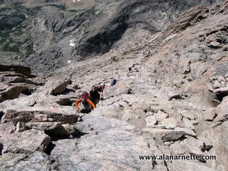
careful and you should reach the top in about 30 to 60 minutes. The boulders at the
top of Trough can be a bit of a bottleneck. You can go straight up the obvious crack
or work your way left but either way takes climbing on all fours. Carefully climb
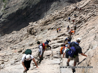
these boulders and pause to take in the next challenge: The Narrows. Not as bad as it sounds but bad
enough that you need to be focused on each step! At some points, you choose between
going around rocks by clinging to a tiny ledge or squeezing between the wall and
the rock. It keeps it interesting! If it is wet or icy, take special care. If you
are not experienced in these conditions, turn back. It can get crowded here in the
summer, so take your time and let people pass you on the outside while you hug the
wall. After climbing up at the end
of the Narrows, you turn North and you can see the edge of the summit. SO close,
yet so far away. Over the next 45 minutes, you walk upright, then on threes and finally
on all fours to the 45 degree smooth granite slab called the Homestretch. If it has
rained, this can be slick as ice. But again with careful concentration, you are soon
at the summit edge. From the Keyhole to the summit, it takes about 2 hours, maybe
more. The last hour you are ready to be in the car heading home or to a nice meal. Your
legs are hurting, you are probably hot and sweaty and you may have some small cuts
on your hands or blisters on your dogs. But, keep in mind that you stood on top of
this big rock! Not something everybody has done but more important: you reached your
goal. This was between you and the mountain ... and you won - this time! Something
you will always remember.
This video is from June 2013 where I ascended the Keyhole route and descended the Loft route. it was Spring weather but still winter conditions. |
|