Colorado 14er: Crestone Peak to Needle Traverse
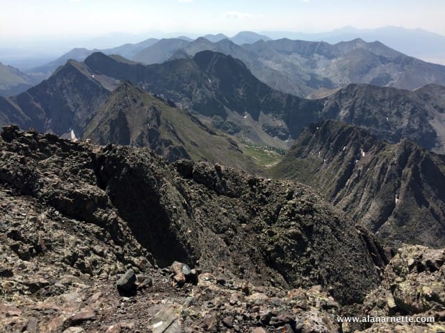
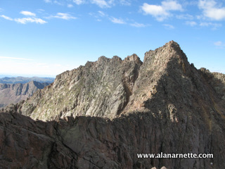
Climbing in Colorado is always special. On August 22, 2015, my buddy, Andy Westmeyer and I climbed two of the more difficult 14ers via a traverse: Crestone Peak to Crestone Needle. Both of the 14,000′ peaks have difficult reputations and the traverse, all above 13,600′ amplifies it. We hiked into South Colony Lake Friday night, set up camp and set the alarm for 2:30 am. The wind was blowing pretty hard so we hit the snooze alarm for an hour and left camp at 4 am for Crestone Peak. We crossed Broken hand Pass as the sun was rising, descended to Cottonwood Lake and begin the climb of the Red Gully. Water was running down the middle of the gully but overall it was sustained climbing on smooth rock. We soon reached the summit of Crestone Peak, 14294′, about 4 hours after leaving camp. We were rewarded with stunning views of the Great Sand Dunes, Crestone Needle, the Sange De Cristo mountain range, and the traverse. We down climbed to 13,650′ to start the traverse. The first 3/4 is easy class 2 hiking but then it turns ugly. The routes goes up and down over rocky outcroppings, crosses steep scree gullies and dead ends into rock walls. At one point the route takes you over a challenging move that some classify as 5.1 – it’s only one move but can make one question if you are on route. We climbed a steep gully that ended with a drop-off of a thousand feet. At that point the route turns back on itself and leads up narrow rock ramps and again into steep walls. The first was a difficult class four that lead to more ups and downs but finally came to an abrupt stop at the final 100′ wall just below the summit of Crestone Needle. I would easily classify this as 5.0 meaning that if you fell, your hair would be seriously messed up. Some people rappel down this wall instead of up climbing it thus making the traverse Needle to Peak. The final stretch to the Crestone Needle’s summit, 14,197′, was an airy walk but once again rewarded us with amazing views all around. The down climb from Crestone Needle is not to be dismissed. It is more steep, loose scree down long gullies all requiring challenging route finding. Choosing the wrong gulley can cost lives as has been shown in previous years. We arrived back in camp, took a power nap before hiking out that afternoon for the long drive back home. All in all we have been on the move for 19 of the previous 24 hours. My old knees were talking loudly as the day ended! This was my second climb of the Travers and third summits of the Peak and Needle. While this is one of the more difficult 14ers in Colorado, it is rewarding to those who try. Climb On! Alan Memories are Everything
Going Through a Cave to Reach Longs Peak Summit
It is not often you go through a cave to reach a mountain summit. But I recently did just that on Longs Peak. I guess I have to say Longs Peak in Colorado’s Rocky Mountain National Park is my favorite 14er given I have climbed on it over 125 times reaching the summit on 33 occasions. I’m not an overly technical climber and use Longs as training for my higher altitude climbs so it was a to explore a new route (for me) with some good friends on July 23, 2013. The Northwest Couloir was first documented by Enos Mills (aka Mills Lake) in 1896. He noted previous evidence of earlier human activity in the couloir. Today it is rarely climbed and often goes unnoticed by the thousands who pass underneath on the Ledges as part of the normal Keyhole route. I have been guilty of this for over a decade. A bit more on Mr. Mills. He went on to summit more than 40 times solo and served as a guide 300 more times. He was instrumental in obtaining National Park status for what we now call Rocky Mountain National Park in 1915. The first documented summit of Longs was by John Wesley Powell and a party of seven in 1868 but it is almost certain the local Native Americans summited well before him. The Northwest Couloir The Northwest Couloir is a Class 4 climb but we used ropes to protect the team as we found verglas near the crux move midway through the gully. It could be climbed without protection but the margin of error is very small and would need to be dry or climbers having solid experience in my opinion. This is a different level than the Keyhole or Loft routes. I had scouted it a few weeks before in early July and found significant ice on the route. The route follows the normal Keyhole approach through the Boulderfield, Keyhole and onto the Ledges. The NW Couloir is the last gully on the left (East) just before the Trough. There is an earlier gully that can be mistaken for the NW but a large rock formation at the top of the gully resembling the Knight chess piece is the landmark to use. The lower climb is straightforward but with the loose rock, it requires attention especially for those below you on the Ledges. The handholds are tenuous, more like something you would find in the Elk Range, not on Longs. Water is often running down the Couloir making the up climb sloppy at times. A series of narrow rock benches create a somewhat easy route but in general staying to the climber’s right worked well for us. The Cave The crux, and most fun move is navigating the cave. Technically it is not a cave but rather a gap between two huge slabs that have become lodged in a narrow chimney, aka pancake rocks. While an alternate route is to the right of the cave, it is a 5.2 – 5.4 slab rock climb. If covered in verglas, as parts were on our day, it would be challenging. The exposure to the lower Couloir is extreme. It doubtful that a cell phone would receive a signal in the Couloir but I didn’t try. The approach to the cave is via the lower chimney leading to a false gap. From there, a move to the right is required to see a decades old ring piton half way hammered into the rock. I would love to know the history of this piece. A decent rock ledge allows for a good foothold to reach the piton and from there a couple of aggressive moves takes you to the entrance of the cave. It was on this move where we put in a couple of nuts for protection. Once at the entrance, we crawled in to see a 16 inch high gap with sunlight on the other end. Our team use a variety of gymnastic moves to wiggle through the gap ranging from bellyflop, to backstroke to sideways crawl but all required removing our packs. Once through the gap, a solid rock platform allows for a safe foot plant. To the Summit The Couloir opens up above the cave returning to a Class 3 rock scramble. At the top it joins the Keyhole Ridge route but well above the rated 5+ sections. A long series of connected slabs take you to the summit plateau. The views of the Trough and climbers looking like ants, dominate the view 600’ below. The views of the irregular rock blocks stacked like dominoes was astounding. Given we had a 60m rope and harnesses, we rappelled down the North Face completing a unique and satisfying day on Longs Peak. Our little team was Stuart Smith, Noelle Smith, Jim Davidson and Alan Arnette The following video was taken by myself and Jim Davidson. I hope you enjoy. Climb On! Alan Memories are Everything
Colorado’s Roof: Holy Cross, Snowmass and Pyramid Peaks
I had a busy week June 24, 2013 climbing three of Colorado’s major 14, and 000 foot mountains. I have climbed all 58 of the 14ers but wanted to go back to each of these for different reasons. I hope you enjoy the videos. Holy Cross via the Halo Ridge I summited Colorado’s Mt. of the Holy Cross, doctor 14,005′ on June 24, 2013 via the Halo Ridge. The Halo Ridge is not the standard route as it requires substantial rock scrambling and a long ridge climb of 2 miles above 13,000 feet. I descended using the normal North Ridge route making it a 13 mile day with a 5420′ elevation gain. I was glad to have perfect weather for this day. Snowmass Mountain via the East Slope I climbed Colorado’s 14,092′ Snowmass Mountain on June 26, 2013 via the East Slope Route. I camped two nights at Snowmass Lake – an unbelievably beautiful setting. The climb was straightforward with some snow, rock scrambling to the summit.The entire trip was 21,5 miles roundtrip with a 5800 foot elevation gain. I had climbed Snowmass a few years ago via the S-Ridge on the West side but had always wanted to see the East approach and was not disappointed. It was Colorado wilderness at it’s finest. Pyramid Peak via the Northeast ridge I climbed Colorado’s 14,108′ Pyramid Peak on June 28, 2013. I took the Northeast Ridge route which has a 4500′ gain over 4 miles. The rock was extremely loose and dangerous and it was critical to stay somewhat on the standard route to avoid additional danger. On the way down, I met three pair of goats with their new kids. Climb On!AlanMemories are Everything
Little Bear-Blanca Great Traverse
Colorado has 58 mountains over 14, salve 000 feet. Within this grouping many peaks have ridges that connect them but only four are deemed worthy to be be called great. On June 14th, 2013, I completed the last of these, the Little Bear – Blanca Traverse. In my opinion it is clearly the most difficult. First I climbed Little Bear, 14,037′ via the rare West Ridge direct route with partners Tom and Barry. This was not the normal Hourglass route. I then continued solo across the Little Bear-Blanca Traverse to summit Blanca Peak, 14,345’. It was an extreme day with unbelievable exposure and fun rock climbing. I had to take cover midway on the traverse when a lightning storm developed overhead. All in all, an incredible adventure in the Colorado Rockies. See the complete report at this link And a few pictures of the climb: Climb On!AlanMemories are Everything
A Look at the Colorado 14ers
This weekend I will be on a special climb of a 14, look 000 foot Colorado mountain, Handies Peak in the San Juan Range. I have already climbed this one but this time it will be with my good friend and 14er buddy, Robert LeClair. This will mark his completion of climbing all 58 of the 14ers, a goal he set 14 years ago. So with this occasion I thought it was be a good time to take a look at the hills that serve as my playground, training course and source of immense pleasure. What is a 14er? Colorado has 58 mountains over 14,000 feet (4,266 meters) in height but only 53 are noted as ’14ers’. To qualify as a 14er the peak must be 300 feet higher than the saddle of an adjacent peak. A notable exception is North Maroon Peak so 54 has become the ‘official’ number. But there are an additional 4 that are counted on many lists due to historic or proximity reasons so many use the number 58 as the total. I have climbed all of them. You can see my complete list. There are six distinct ranges that hold these 14ers plus hundreds of lesser peaks. All this makes Colorado one of the climbing areas in the world. Many are very easy to reach with several within driving distance of Denver and other Front Range cities. A few require overnight backpacking trips and are well worth the effort. Please read my FAQs for some common questions and answers. For a look at what to pack, see this post. The Danger The obvious danger for any mountain is the weather. The standard warning is to be off a summit no later than noon in the Colorado summer or risk being hit by lightening or trapped in a raging thunder (or snow) storm. After that, there is rockfall, heart attacks and simply falling. Each year we see numerous deaths. 2012 has been relatively safe with sadly, around 5 lost lives thus far. I wrote about a particularly difficult year in 2010 with 11 dead on Colorado 14ers. This is a good overview of the 9 deaths on 14ers in 2011. Interesting Challenges What is about mountains (and oceans and wind and …) that cause people to set records, break them and then start all over? The 14ers are no different. There are numerous records (mostly self defined and verified) ranging from fastest to slowest to most, to downright strange. But most serve to entertain and inspire followers. The summer of 2012 saw one that captured the attention of 14er lovers all across the country. John Prater aka “Homie” set out on August 23 to summit 55 14ers in under 10 days 20 hours and 26 minutes – the record set in 2000 by Ted Keizer “Cave Dog” ( what’s with these handles? – sounds like something out of Top Gun). This particular record and attempt was amazing in that these guys basically ran up and down the Hills, almost never sleeping but had a support team driving them from peak to peak. Well in the end Homie bagged 41 of the mountains in 7 days yielding to severe leg pain. Another interesting feat was sleeping on the summits. I attended a presentation recently by Jon Kedrowski and Chris Tomer documenting Jon’s successful project to spend the night starting at sunset and ending at sunrise on each 14er summit. Chris joined him on many. Chris, a meteorologist, provided Jon up to the minute weather forecasts but that did not prevent a near miss when a lightning strike almost destroyed his tent, and Jon himself, on Mount Harvard. They have a book. Classifying a 14er The common way of describing the difficulty of a mountain climb in the US is by the Yosemite Decimal System. It starts at 1 (a sidewalk) and goes to the obscure 5.XX range where humans mimic goats. Climbing Class Ratings (based on the Yosemite Decimal System) note: route difficulty is determined by the most difficult section so a route can have 50 feet of Class 3 and 6 miles of Class 1 and be classified and be rated as Class 3. Class 1: Trail hiking. Mostly groomed trails that are easy to find in the summer and relatively smooth. Walk upright without use of hands for balance. It can be a little steep at times. Mount Elbert, the highest 14er, is Class 1 on the standard route. Class 2: Simple off-trail hiking. Some scrambling may be required on the route with an occasional use of the hands for balance. Downclimbing is straightforward. Mt. Massive is a class 2 route with some scrambling required near the summit using hands for balance. Class 3: This is actual “climbing” since you scramble a lot frequently using your hands. Handholds are easy to find. You can downclimb facing out from the rock. Longs Peak’s Keyhole route is rated class 3 but like most routes it is easy class 1 most of the time with the upper sections becoming more difficult thus making the route a class 3. Class 4: Simple climbing, with exposure. You must look for handholds and test them that they will hold you before using. You use your upper body muscles. A rope is often used for downclimbing (rappelling). Falls may well be fatal. The North Maroon Peak is class 4 with the traverse from South to North rated low class 5 on the upclimb on the North Bell. Class 5: True technical climbing normally using ropes, carabineers, anchors (protection), harness, etc. Climbers often belay one another. In the winter you use an ice axe and crampons. Long’s Keyhole route is rated “technical” in the winter beyond the keyhole since an axe and crampons are used. There are sub-ratings for class 5 ranging from 5.0 for “easy” climbs with frequent hand and foot holds to 5.13 that is has smooth and vertical rock on an overhang. There are an almost unlimited number
A Tough summer in the Western High Country
Any article about death on a mountain is difficult to write. I am concerned about getting the facts wrong, stuff perhaps offending family and friends. However, it serves a purpose of exploring the reason for incident and reminding everyone that mountains can be deadly. The source year after year is the American Alpine Club’s – Accidents in North American Mountaineering published annually to members. This article is a partial overview of the tragic events thus far in 2010. Many people associate death in the mountains with the well publicized events on the big climbs like Everest or K2. But each year, many climbers lose their lives on the 14,000′ or lower mountains in California, Colorado, Washington or Wyoming. It has been particularly tough in Colorado the summer of 2010: Little Bear, June – fall in the Hourglass couloir covered in veriglass. more Longs Peak, July – fall near the summit, cause unknown. more El Diente/Wilson Traverse, August – rockfall on the traverse. more Crestone Needle (2 people), August – fall on technical climb of Ellingwood Arete in difficult weather. more Maroon Bells Traverse, August – rockfall near Bell Chord Couloir. more Longs Diamond Route, August – fall from Broadway during technical climb. Kit Carson, September – fall near the Avenue. more Longs Peak, September- fall on the Ledges more El Diente, September – rockfall more Meanwhile, a well publicized accident in July on the Grand Tetons took one life and caused the evacuation of 16 climbers when lightening hit the peak. The actual cause of death for the one climber is still unknown more. Another incident took another life on the Middle Teton in July, again the cause of the fall is unknown at this time. more And in California, there was a death on Mt. Shasta in April after a strong storm hit the mountain. more Another climber was killed in July by rockfall more. In Washington State we saw several deaths on Mt. Rainier. Ingraham Glacier avalanche, June – solo climber in difficult conditions more. Disappeared near summit, July more. Crevasse fall on Emmons Glacier, July more. In February, a very experienced climber fell into the crater from the summit of Mt. St. Helens more. And another climber died on nearby Mt. Hood after severe weather hit the mountain in June more. Some of these incidents were caused from rock fall and some climbers were not wearing helmets, some were; but it serves as a good reminder to use a helmet on any route above class 2 at a minimum. Weather was not a huge issue in most of these incidents but heavy monsoon rains could have contributed to the incidents in southwest Colorado’s San Juan range which saw multi-day deluges thus loosening rocks and soil. Some of these incidents were simply part of mountaineering. However, it is always good to think about how to avoid becoming involved in one thus a few thoughts: avoid putting yourself in any dangerous situation through good judgment, knowledge of the terrain and applicable experience understand the local weather trends, know the current forecast and how to read changing conditions If you are exceeding your experience or comfort level, go with more experienced climbers or turn back bring the proper gear and clothing for a wide range of weather conditions even on the nicest days know basic first aid never depend on a locator device or cell phone for assistance or to justify going beyond your comfort level but always carry one to aid in a rescue know the techniques of survival in harsh conditions never climb alone or leave your team, especially on unfamiliar terrain There is no good news in a story like this other than providing information that can hopefully prevent a similar tragedy. My sincere condolences to everyone involved in these accidents. Note: updated with another death on Colorado’s El Diente on September 28th.
Finishing the 14ers; What’s Next?

For not being a goal, the satisfaction I feel for just completing climbing all 54 Colorado mountains over 14, 000′ is deep. As I posted last week, I went to southwest Colorado’s San Juan range to climb Windom Peak (14082?), Sunlight Peak (14059?), Mt. Eolus (14083?) and North Eolus (14039?). I was fortunate to have my regular partners, Patrick and Robert along and some new friends, Anne and Kevin plus John Little from Houston, Texas. There are new trip reports for all the climbs on my main site. Mt. Eolus and North Eolus Windom Peak Sunlight Peak The plan was to take the Durango & Silverton Narrow Gauge railroad to a wilderness drop-off point and backpack 6 miles into the Chicago Basin We would climb the Eolus Peaks on Sunday followed by Windom and Sunlight on Monday. Relaxing on Tuesday morning, we would then hike out to catch the train back to Durango. Well that was the plan. We successfully got Eolus per plan and I am especially proud of and for John who made it in style with this being only his second 14er after the class 2 Mt. Belford with me last year. We had excellent weather and thoroughly enjoyed the day as a group. The only hitch was when Patrick dislodged a large rock scraping him up and almost sending him down the mountain face. It was a close call. The next day, Monday, opened with low clouds, constant drizzle and occasional sleet. However, a subset set of the group went on to summit Windom Peak in almost zero visibility conditions. So for me, that left Sunlight as my last 14er out of the total 54. I wanted to summit on August 16, the one year anniversary of the passing of my mom, Ida, as a tribute to her and to finish my 14ers. Plus to launch my 7 Summits quest where I will be raising awareness and $1M in research money. However, the mountains had a slightly different plan. After Windom, Robert and I started up Sunlight but the conditions worsened. I continued solo to the summit ridge when the clouds thickened causing me to choose re over pushing a bad position. However, not to be stopped, I left camp at 4:00 AM on Tuesday to complete my 14ers. Alone on the summit, I took this picture. It will be a moment forever etched in my memory. I caught the train per schedule and enjoyed a celebration with John since everyone else had to leave to get back home. The satisfaction I feel is one of pushing through to the end to complete a goal. As I look back on my climbs, I can trace phases in my life – new friends, serious changes, great experiences, meaningful losses. The constant being the attraction to climb the mountain, to feel the summit, to accomplish the goal. Made all the better with friends. With the 14ers now completed, I will continue to climb them; it is part of who I am. Next week Robert and I will go to the Maroon Bells where Robert will break into the 50’s of his 14er quest. I plan to summit my local, Longs Peak another 5 times this year bringing that total to 25 as part of my ongoing training. And of course, to start climbing the 7 Summits in November with Antarctica’s Mt. Vinson and ending with Cartsensz Pyramid in late 2011. Yes, this includes Everest in April and May of 2011. My goal is to raise awareness and research money to find a cure for Alzheimer’s. I have lined up an impressive team of committed industry partners and it will be a major event for the almost one year. There will be opportunities to participate through joining a climb, making a donation or just following along. To plant a seed, consider making pledge for one or all the climbs based on how high I get on each climb. Your donation would go to Alzheimer’s non-profits and nothing to me or to fund the climbs. Here is how it would work: If you commit one penny for Denali as an example, you would donate $131 to Alzheimer’s research. It would only be $807 for all 8 climbs over 12 months, probably less than you spend on coffee at $2 a day. This is the schedule for a penny per foot climbed: Mountain Summit Start Gain $0.01 1 Elbrus 18,841 12,795 5,686 $57 2 Kilimanjaro 19,340 5,363 13,977 $140 3 Vinson 16,067 7,000 9,067 $91 4 Aconcagua 22,841 8,464 14,377 $144 5 Everest 29,035 9,400 19,635 $196 6 Denali 20,320 7,200 13,120 $131 7 Carstensz Pyramid 16,023 12,467 3,556 $36 8 Kosciusko 7,310 6,026 1,284 $13 Much more will be announced but if you have questions now, please contact me. Climb On! Alan
The Final 14ers
Sometimes a goal is not a goal until you near the end. That is my story for climbing all of Colorado’s Mountains over 14, 000 feet. My first 14er was Longs Peak in 1992, then a few more in 2002. I got serious after meeting Patrick Vall and Robert LeClair. They both wanted to climb all the 14ers and I needed the training for my Himalayan climbs throughout the decade. Thus one by one, we started climbing them all. This weekend I will travel to an area named the Chicago Basin and climb three of the ranked 14ers thus competing my climbs of all 54 in Colorado. OK, actually my final climb will be number 59 since there are some 14ers that are called 14ers but are not included on THE list because they are not 300′ higher than the saddle connecting to another 14er! Oy!! In any event, the final 3 (4) are Windom Peak (14082′), Sunlight Peak (14059′), Mt. Eolus (14083′) and North Eolus (14039′). They are in the awesome Needles Mountains of the San Juan Range in southwest Colorado. The trip starts with a 30 mile ride on a steam train from Durango that takes two and half hours. The train pauses at a bridge in the middle of nowhere and drops climbers off with their gear. From there we backpack about 6 miles to Chicago Basin where we will establish camp for the next couple of days. In addition to Patrick and Robert, a new friend John Little will join us. John is new to climbing. We made his first 14er summit last year on Mt. Belford. John has trained hard for this next challenge and it will be fun climbing with him. For me this climb is special in a number of ways. First, this is the kind of adventure I dreamed of growing up in the hot, humid and flat land of Memphis. As a Boy Scout, I loved camping but it was limited to the thick forests of Tennessee and Mississippi. Reading Outdoor Life, Field and Stream and Boys’ Life magazines, I saw pictures and read in detail the stories of backpacking into the wild and remote areas of the Colorado Rockies. I had my external frame pack, heavy leather boots and cotton sleeping bag. I did own a puffy down jacket but it was not that useful in the South! I could only dream of what it was like in the rarefied air at 14K. But there is more to this climb than just a climb. On August 16th it will be one year since Alzheimer’s took my mom, Ida. I will celebrate her life with my final 14er summit on Sunlight Peak. Climb On! Alan
Finding Clark's Arrow on Longs Peak
Sometimes it is the little thing. I have climbed on Longs Peak perhaps 70 times in all kinds of weather by multiple routes. But one small goal has eluded me for years. You see, way back in the early days of Rocky Mountain National Park, an enterprising ranger named John Clark decided to help out his fellow climbers by painting an arrow directing climbers to the saddle between Longs Peak and Mt Meeker. The area is a rock filled gully and can be very confusing so some type of semi-permanent sign would have been useful. Of course today that would be illegal and considered graffiti!