7-Summits-in-One-Year-Podcast-with-Garrett-Madison

As we close out 2025, I caught up with Garrett Maddison, founder of Madison Mountaineering, for a rare moment while he was home in the Seattle area. Garrett summited all of the Seven Summits (Messner List) in 2025, plus had some interesting times on Cho Oyu, watched one of his teams struggle, like the others, on K2, and is actively guiding on Vinson. We discussed all this, including what to expect for Everest in 2026, with the more expensive permit fees, new requirements for Everest applicants from China, and proposals from Nepal. #everest2026

Two Dead on Carstensz Pyramid-Update with Video

Carstensz Pyramid

Deaths on Carstensz Pyramid, one of the Seven Summits, are rare, but two women tragically lost their lives on March 1 while descending during a storm. The 4,884-meter (16,024-foot) peak poses challenging logistics and is the most technical of the seven, requiring basic rock climbing skills for primarily 5th-class terrain on fixed ropes.

PROBLEM: FeedMedic Alert for TheBlogOnAlanarnettecom

FeedBurner had trouble retrieving your Source Feed: http://www.alanarnette.com/blog/feed/
The error message is:
Error getting URL: 502 – Read timed out / server unresponsive at the requested source URL
Actions you can take:
Validate your Source Feed …

The 7 Summits – an Overview
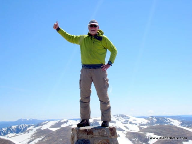
Alan on Kosciuszko's Summit

In 2011, I summited seven of the eight seven summits. Confused? Read on! This post is a quick overview of the 7 Summits. My climbs were aimed to send a message of hope, need and urgency from the 7 Continents on behalf of everyone impacted by Alzheimer’s Disease. I made all the climbs in just 322 days. You can read more about each mountain, my personal experience and frequently asked questions by click on the links For an excellent book covering all the climbs, check out mountain guide Mike Hamill’s Climbing the Seven Summits. The 8 “7 Summits” The 7 Summits represent the highest point on each of the seven continents. It has become a goal for climbers around the world and around 416 people have met the goal as of 2016. See the list at this link. However, as in most things in mountaineering there is controversy. From a geology viewpoint, there are only 6 continents on the Earth: Africa, Antarctica, Australia, Eurasia, South America and North America. Europe is considered a peninsula of the Eurasia continental platform and is not a true physical continent. However, from a political perspective, Europe is considered a continent thus Elbrus (18,513’/5642m), located on the border with Asia in southern Russia represents Europe and not Mont Blanc (15,771’/4807m) which lies in the Alps on the border of France and Italy. Then there is the competition between Australia’s Kosciuszko (7,310’/2228m) and New Guinea’s Carstensz Pyramid, aka Puncak Jaya (16,024’/4884m) both located on the Oceania continent – which is not really a continent but a region of the south west Pacific that includes Australia, Fiji, New Zealand, Papua New Guinea, Samoa and many other islands. Just top make your head spin a bit more, Mawson Peak at 9,005’/2,745m on the Heard Island and McDonald Islands, is part of Australia and higher than Kosciuszko but not higher than Carstensz Pyramid. Dick Bass the first 7 Summiter, choose Australia as one of the 7 continents and Kosciuszko as it’s mainland high point. However Canadian Pat Morrow, who was competing with Bass to finish the 7, challenged Bass’s summit of Australia’s Mt. Kosciuszko as the highest peak in Oceania saying that Carstensz Pyramid on Irian Jaya (Papua) in Indonesia’s New Guinea was the true highpoint for the Australasian continental mass. Italian Reinhold Messner jumped in and agreed with Morrow. Today Carstensz is considered one of the seven but some 7 Summiteers try to bag the lower Kosciuszko to meet both the Bass and the Messner lists. Of the 416 7 Summiters, 148 have summited both Carstensz and Kosciuszko. So I guess if you want to cover all angles here is the list: Everest, Nepal – 29,035’/8850m Aconcagua, Argentina – 22,902’/6960m Denali, Alaska – 20,320’/6194m Kilimanjaro, Africa – 19,340’/5896m Elbrus, Russia – 18,513’/5642m Vinson, Antarctica – 16,067’/4897m Carstensz Pyramid, New Guinea – 16,023’/4884m Mt. Blanc, France/Italy – 15,771’/4807m Mt. Kosciuszko, Australia – 7,310’/2228m The 7 Summit idea was hatched and first accomplished by American Dick Bass. He started with six summits in 1983: Aconcagua, Kilimanjaro, Elbrus, Denali, Vinson and Kosciuszko. Then with guide, David Breashears, he became the oldest person, at 55, at the time to summit Everest in 1985. Canadian Patrick Morrow became the first to summit all seven with Carstensz in addition to Kosciuszko ending in 1986. Messner summited all the peaks without supplemental oxygen, a first, also completing the task in 1986. The 2nd 7 Summits Finally, since none of the seven are extreme technical mountaineering climbs, with the altitude challenges of Everest notwithstanding, some pundits suggest the second highest mountains on the continents is a better challenge for real mountaineers. I would agree that that list would be significantly more difficult if only for the fact that it includes K2 instead of Everest! That list includes: K2 (Pakastan-28,251’/8611m) Ojas del Salado (Argentina-22,608’/6983m) Logan (Canada-19,551’/5959m) Dykh-Tau (Russia-17,077’/5205m) Kenya (Africa-17,057’/5199m) Tyree (Antarctica-15,919’/4852m) Puncak Trikora (New Guinea-15,580’/4730m) Townsend (Australia-7,247’/2209m)   If you dream of climbing mountains but are not sure how to start or reach your next level from a Colorado 14er to Rainier, Everest or even K2, I can help. Summit Coach is a consulting service that helps aspiring climbers throughout the world achieve their goals through a personalized set of consulting services based on Alan Arnette’s 20 years of high altitude mountain experience and 30 years as a business executive. Prices and services at the Summit Coach website. Here are the 7 Summits in height order and my experience. Asia: Everest (29,035’/8850m) Mt. Everest is on the border between Nepal and Tibet (China). It is in the Himalaya mountain range which stretches 1500 miles from Northeastern Pakistan to Bhutan. There are over thirty mountains higher than 25,000 feet and fourteen over 26,300 or 8000 meters. Of the fourteen 8,000 meter peaks, nine are located in the Himalayas making it clearly the top of the world. Mt. Everest was first summited by Sherpa Tenzing Norgay and Edmund Hillary with a British expedition in 1953. They took the South Col route which is described on this page. At that time the route had only been attempted twice by Swiss teams in the spring and autumn of 1952.They reached 8500m well above the South Col. Of note, Norgay was with the Swiss thus giving him the experience he used on the British expedition. The Swiss return in 1956 to make the second summit of Everest. Today, hundreds of climbers from around the world use the South Col route to try to stand on top of the world. It is considered slightly more dangerous than the North Ridge Route due primarily to the instability of the Khumbu Icefall. However some considered it slightly easier than the north due to the absence of the ladders and rock climbing on the steep steps of the North Ridge route. The Grand Dame of all Everest statistics, Ms. Elizabeth Hawley reports on the Himalayan Database that there have been 7,646 summits of Everest through June 2016 on all routes by 4,469 different people. 1,015 people, mostly Sherpa, have summited multiple

Documentary on Alan’s 7 Summits Climb for Alzheimer’s
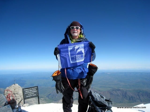
Alan on the summit Mt. Elbrus

I am very pleased with a 6 minute documentary by the AARP on my Summits Climb for Alzheimer’s: Memories are Everything project. The producer, Lauren Cardillo, did a great job of taking my original pictures, videos and our live interview to tell the story of Ida Arnette, Alzheimer’s and my passion to make a difference. The film is scheduled to air on AARP’s television series, My Generation, hosted by Leeza Gibbons the week of September 16, 2012. My keynote presentations expand on the themes I discusses in the film. I want to remind anyone in the West Tennessee area that I will be speaking on behalf of the Pat Summit Foundation on October 7th. Also at Yale University Master Tea on September 27. As usual, I want to remind everyone that all donations go directly to your choice of Alzheimer’s organization to raise awareness, and research money; none ever to me. Climb On! Alan Memories are Everything

Vinson Massif

Route from HIgh Camp (Vinson not visible)

Antarctica 16,067′,4897 meters Summited December 9, 2010 7 Summits Climb for Alzheimer’s 600 miles from the South Pole, Mount Vinson was first summited in 1966 by climbers led by Nicholas Clinch from the American Alpine Club and the National Science Foundation. It was the last of the 7 Summits to be summited. It was named after US Senator and Antarctica supporter Carl Vinson. It is in the Ellsworth Mountains Range. Just getting there is an adventure. The flight previously was a four-hour, 20,000-mile trip on a Russian Ilyushin 76 cargo plane, but today (2025) is a sleek 757 outfitted with Business Class seating throughout the plane. The flight is from the tip of South America to the snow camp of Union Glacier Hills. Once there, climbers are ferried via a Twin Otter to base camp. Climbs usually take place between December and February. The climb is usually scheduled for about three weeks, with the summit in the middle of the climb. However, once there, the weather can be the worst on the planet, often stopping teams in their tracks for weeks. Like Denali, climbers carry all their gear plus a share of the group gear – no porters in Antarctica! The climb is a series of long snow slopes not requiring significant technical skills or gear; however, it is harsh with the weather and loads over 70 lbs split between a pack and a sled. Once you summit, if you summit, you might be stuck for more weeks waiting for the jet to return! About 1200 people have summited Vinson since 1966. There have been no deaths. A popular option after a summit is to fly to the 89-degree and ski the final 70 miles to the South Pole. The second highest mountain in Antarctica is Mount Tyree at 15,919’/4852m and is 7 miles north of Vinson. Only seven climbers have made it to the top of Tyree! It is significantly more complicated with its steep faces. One of the most famous climbs in mountaineering took place in January 1989 when the legendary American alpinist Terry ‘Mugs’ Stump, an American climbing legend, soloed the west face without a rope in a roundtrip time of 12 hours – a fantastic feat that still stands out 20 years later. Vinson Resources: 2010 Summit Climb Climb Report Vinson Dispatches Vinson FAQ 7 Summits Climb for Alzheimer’s In late 2010, I launched the 7 Summits for Alzheimer’s campaign, where I wanted to climb all seven (eight) of the Seven Summits in one year. The first summit was Vinson in Antarctica on December 9th, 2010. This was the last summit on October 25, 2011. I had made every summit except Denali, which was stopped by weather, 3100′ short of the summit. I have been able to send our Alzheimer’s message of hope, need and urgency from each continent, reaching over 12 million people and raising money for research, awareness and caregivers. In 2025, I will continue to dedicate my climbing and public presence to honoring my mom, Ida, and raising research funds for Alzheimer’s nonprofits. Please consider a donation today.

Vinson Trip Report

Team Working the Ridge to Vinson's Summit

Antarctica 16,067′,4897 meters Summited December 9, 2010 7 Summits Climb for Alzheimer’s   Pristine and perfect—Antarctica. I am unsure how else to describe my experience climbing her highest peak, Mt. Vinson. As this was the first of my 7 Summits Climb for Alzheimer’s, where I am raising awareness and money for research, it was critical to have a good start. And it was. I left the US just before Thanksgiving 2010 to meet Phil Ershler, co-owner of International Mountain Guides, and the rest of our team. The uneventful 30-hour journey followed the South American coastline, with a few plane changes along the way. There was a sense of excitement as we landed in one of the most remote cities in the world, Punta Arenas, Chile. I met two team members at the airport and shared a taxi to the hotel, where I met the rest. Excellent first impressions created confidence that this would be a good trip. The Preliminaries First on the agenda was a briefing with Antarctica Logistics and Expeditions, ALE. The room held about 50 people with various objectives—visit the South Pole, ski the last degree, visit an Emperor Penguin colony or climb mountains. Our common bond was a love of adventure and a sense of appreciation for being able to visit the “Last Place on Earth.” The two-hour briefing covered many details but honed in on our responsibilities to protect Antarctica. We left the meeting with a heightened awareness and anticipation of when the big Russian jet would depart. And that may be the common theme of all polar adventures. You see, it takes a specialized aircraft, unique flying skills, uncanny weather forecasting capability and agreeable weather just to start the journey. Thus, we were told to be prepared to leave our hotel on a two-hour notice, fully dressed in our -40F clothing. Every expedition is full of rumors, usually of a death on the mountain, an unexpected summit push or some petty politics. But we had none of that. One topic dominated our conversation from start to finish – wheels up time. Today or tomorrow? I just heard the winds are too high, or a front is moving in. What if we can’t get out for another week – and on and on? The keyword is patience. Polar travel is a case study of human traits we seek, and few achieve. However, everything aligned, and we learned that the Russian jet would depart Punta at 5:00 PM on November 27th. Flying to Antarctica That Russian jet – what a piece of machinery. Specifically, it is an IIyushin IL-76. Designed by the Soviets in 1967, it was built to service the remote areas of the old USSR. Today, it is used around the world for heavy lifting. With four massive engines, a back-loading ramp that trucks can drive onto and sparse interior furnishings, it carries everything from machinery to other planes to water for firefighting – and sometimes Antarctic mountain climbers. ALE leases the IL, as it is nicked named, from November through January to service their Base Camp named Union Glacier. They and previous companies have flown various specialized aircraft to Antarctica since 1983 using the prior base of Patriot Hills. However, weather delays caused them to search for a more stable area like the new Union Glacier site. In reality, all these locations are simply GPS coordinates on the ice. The key feature is a long strip of natural solid blue ice, void of cracks, holes or crevasses, enabling the big IL to land and take off reliably. So it was that we left Punta approximately on time for the 4:05 flight to Union. The flight was an exercise in organized chaos as 50 adventurers, dressed in full down, boarded the jet and took our seats three abreast, violating one another’s personal space with clunky boots and puffy down jackets. But given that the inside of the IL was marginally heated, no one complained. And we were going to Antarctica! The in-flight service consisted of receiving a cotton wad to plug our ears due to the lack of insulation inside the IL from the engine noise. Once in flight, we were served a piece of cheese between two slices of white bread and a cookie. I felt like I was in a scene from The Hunt for Red October as the Russian crew looked on. As midnight approached the sparse crew prepared us for landing with a quick walk through checking seat belts, yes there were seat belts! The only windows were attached to the emergency exit doors, so I had no sense of how close we were to the ground until I craned my neck to see the tip of a high mountain – snow-covered. My heart jumped. A solid thud marked our arrival, along with the even louder noise of all four engines in reverse thruster mode – no brakes on the ice. We coasted to a stop on the 3-mile runway. As soon as the doors opened, we knew we had arrived. Walking like penguins, we waddled our way to the door, down the metal stairs and onto the ice. My first step on the Antarctic continent was a moment, a memory, forever stored. The air was crisp. The sky was a turquoise blue. The sun hovered just above the surrounding mountain peaks of the Heritage Range of the Ellsworth Mountains. It was midnight. Union Glacier Met by the Union Glacier Base Camp team, we rode in a wooden sled loaded with food bags, portable walls, mattresses and backpacks pulled by a snow-cat on treads. It was a chilly introduction as we made the 5 miles to Union Glacier base camp proper. Since this was the first entire season after moving from Patriot Hills, the staff was still establishing Camp, but we were ushered into a long, narrow WeatherPort structure complete with solid floor, table, and chairs but no heat. A buffet of lasagna and bread was offered and received. Of

Vinson FAQ

Alan on the summit of Vinson December 9, 2010

Antarctica 16,067′,4897 meters Summited December 9, 2010 7 Summits Climb for Alzheimer’s About Vinson Q: Where is Vinson A: 600 miles from the South Pole, Mount Vinson was first summited in 1966 by climbers led by Nicholas Clinch from the American Alpine Club and the National Science Foundation. It was the last of the 7 Summits to be summited. It was named after US Senator and Antarctica supporter Carl Vinson. It is in the Sentinel range of the Ellsworth Mountains. Just getting there is an adventure. The flight previously was a four-hour, 20,000-mile trip on a Russian Ilyushin 76 cargo plane, but today (2025) is a sleek 757 outfitted with Business Class seating throughout the plane starting from the tip of South America to the snow camp of Union Glacier. Once there, climbers are ferried another 35 minutes via a Twin Otter to Vinson base camp Q: When is it usually climbed? A: Climbs usually take place between December and February. – the 24 hours of sunlight a day in summer in Antarctica. Q: I understand that Vinson is easy. A: It is straightforward, with mostly glacier travel, but the climbing is not Vinson’s challenge; it is the weather and the logistics of getting in and out of Antarctica. Q: How does Vinson compare with Denali or Rainier? A: It is easier than Denali since it is shorter—if the weather is not brutal. We sat in our tents at Low Camp for six days, waiting for 50 mph winds to ease on the summit ridge. Like Denali, you pull a sled with personal and group gear, but the loads are lighter. Even though the summit is about 16,000′, the effective altitude is about 2,000′ higher. Q: Is a Vinson climb dangerous? A: Absolutely. While there have been no deaths on Vinson, which is remarkable, there are cases of severe frostbite. The primary issue is that in case of a life-threatening emergency, it could take days or weeks to get you back to a hospital, given the severe weather conditions. Q: How many people had summited, and how many people had died trying? A: An estimated 1,200 climbers have summited Vinson at an extremely high success rate. There have been no deaths. Training, Gear & Communication: Q: How did you train for this climb? A: I usually climb my local Colorado 14ers, plus daily workouts with weights and on an elliptical machine. Q: Was altitude a problem on this climb? A: It’s not a big issue, given that it is 16,000′. However, the barometric pressure is quite low at both Poles, so the available oxygen per breath is lower than at the given altitude compared to other big mountains. Thus, from a cardiovascular perspective, it felt like it was 18,000′. Q: What kind of equipment did you use? A: Mostly, I use the same gear I used on Everest—lots of layers. My technical equipment included a long-handle ice axe, harness, carabineers and crampons. Protecting my toes, fingers and face is critical since they are most susceptible to frostbite. As for warmth, I always wear a knit cap and at least liner gloves when I get the least bit cool – regardless of the outside temp. I use a three-layer system of Merino wool base layer (top and bottom), heavier fleece as in a Farmer’s John kind of suit or just my Gortex Pants, depending on how cold it is that day, then my top wind or warmth layer e.g. Patagonia Micro Puff and/or JetStream Shell. When the winds pick up, and the temps hover at -30F, I add an 850 Fill Down jacket plus my mitts, which I never used on Vinson. Q: Is anything special in your gear for Vinson? A: I took almost all my extreme weather gear except the full-down suit. It can be extremely cold and windy, so multiple down layers are required. My boots were the Kayland 8001, an integrated gator boot with a separate inner boot similar to the Millets or Olympus Mons. Some people climbed in double plastics with overboots. I was never cold. I was pleased when I used a new sleeping bag from Mountain Hardwear, the Wrath -20—I also used the ExPed Down mat 9 on top of a Z-pad. I was warm and comfortable. Q: Did you use a satellite phone? A: I used an Iridium phone with good results to post updates to this website. Expedition Basics Q: Which route is most prevalent? A: There is only one primary route from the west side, which follows the Branscomb Glacier and has two intermediate camps. In 2001, a team climbed via the East Face. In late 2008, one team climbed to the Shinn Col via the Dater/Hinckley glaciers before joining the regular route. Q: How long will it take? A: A Vinson climb can be incredibly short. With zero weather delays, you can arrive at Union Glacier, fly to Vinson Base Camp, climb to Low Camp, then High Camp and summit, plus return in about a week. But this seldom occurs. Count on three weeks with weather delays. Q: How much does a standard climb cost with and without a guide? A: For 2025, the costs are around $55,000. The cost is so high due to the logistics of getting to Antarctica. Once you are there, you can see why. Q: Do I need a permit to climb? A: There are no permits, but you must use Antarctic Logistics and Expeditions(ALE) to fly to Antarctica since they are the only ones allowed to fly there. Q: Do I need a guide for Vinson? A: ALE requires a guide to climb unless they approve you as an exception with proper experience and a team of 3 or more—don’t count on it. They can provide a guide, or any other guide company will provide one. In my opinion, you must bring a two-way radio and a satellite phone and have the frequency or number of the local rescue resources already programmed in. Q:

7 Summits Gear Review

Climbing 8 big mountains in 11 months required many things but proper gear was a must. In this post, I will review what I used, what worked, no what didn’t;  taking it a layer at a time. To review, I did 8 climbs with 7 summits in 11 months. They were: Vinson (Antarctica), Aconcagua (South America), Everest (Asia), Denali to 17K when stopped by weather (North America), Elbrus-North (Europe), Kilimanjaro (Africa), Carstensz Pyramid (Oceania), Kosciuszko (Oceania). I will refer to the mountains as coldest: (Vinson, Denali and Everest) and warmest (Kilimanjaro, Carstensz and Kosciuszko) with Aconcagua and Elbrus in the middle. I am not a sponsored climber by an outdoor company and bought the majority of my gear with my own money with a few exceptions I note.   CLOTHING Base Layer – body and feet I love merino wool and this year validated my confidence. I wore the same First Ascent (FA) top and bottom base layer on every climb – one pair without change. Even after 6 weeks up and down Everest, it never stank, felt clean and did what a base layer should do. While FA worked well, any merino wool base layer is a good . I did use Patagonia polyester/spandex blend briefs while trekking and low on climbs and switched on summit pushes to a heavier Cloudveil wool/spandex brief for extra warmth. As for socks, I bought the cheapest pair of merino wool socks from REI. I used the same four pairs for all eight climbs. I always kept a pair in reserve for my summit night. Also I used a pair of somewhat thick merino socks for lounging in the tent and especially cold nights in my sleeping bag. They never went into a boot. As much I love my merino wool, I have a absolute favorite I have worn for years, the Mountain Hardwear Power stretch suit.  It is made from Polartec and is warm, protects from wind pushing through layers and very comfortable as a one piece suit (with conveniently placed zippers front and back!). A life saver on the extreme days. I wore it on all the ‘cold’ climbs for summit night and always above C2 on Everest. Head, Hands and Eyes First on the head covering, it is critical to note that every, and I mean every, jacket I own has a hood. It is a critical part of my overall system so when it gets windy or cold, I pull it up. I also wore a wool knit cap I bought 10 years ago as my primary skull hat. It is simple and effective. I took a ball cap for full sun days but only occasionally used it. I carried a full balaclava but again almost never used it, even on the Everest summit push. I used a thin Buff and it was a critical item keeping my neck and face warm but allowing easy ventilation. A must have on every climb. I wore several thin pairs of running gloves that wore through on every climb but protected my hands from excessive sun on the treks to base camp. My go-to gloves were from Mountain Hardwear (MH), where I had a pro deal. I used their Torsion gloves as my primary, mild weather layer and on Carstensz where the rock was razor sharp. As I gained altitude or the weather closed in I used the MH Medusa full gauntlet gloves with an incredible removable fleece liner. I user the liner more often than any other glove. But when it got cold, I pulled the Medusa’s on and was never cold. On Everest I used my Black Diamond (BD) Mercury Mitts with the MH liner. I could hold my ascender and clip in and out of the fixed ropes just fine. And my hands never got cold even in -20F temps at 40 mph winds. I did use chemical hand warmers from Grabber on Vinson, Denali and Everest – they worked well but not as long as advertised. Eye protection was simple, I used a pair supplied to me from Julbo, the Explorers. They were comfortable, and protected my eyes in all conditions from blizzards to bright sunny day. I liked the integrated strap for a tight fit in windy conditions. While I wore goggles on Everest, I could have used the Explorers from base camp to summit and back. The lenses did fog and freeze up on Vinson. I used the fashionable Beko nose guard on Denali. Outer Layers Bottoms For the treks, including in and out on Everest and the warm climbs, I used the MH Matterhorn, zip-off thin nylon pants. On occasion I wore my base layer bottoms under these on chilly days. High on all the mountains, including Everest, I wore my Patagonia Guide Pants. They are lined and have a wind proof outer shell (polyester/spandex). My legs were never cold even in Antarctica when the temps were -30F at times. I appreciated the suspenders as I lost weight. Extremely satisfied with these pants. I almost always carried my emergency layer of the Arcteryx full Gortex Bibs on the coldest climbs. They serve as my bomber layer in extreme conditions – wind and water proof. I never used them on any climb, except Aconcagua, but they have saved my bacon several times in harsh conditions. I only experienced rain twice: Kili and Carstensz. Both times the Patagonia Rain Shadow jacket and pant were perfect – breathed well and kept me dry. I packed the MH Chugach pant for the coldest weather climbs (Vinson, Denali, Everest) and use them as a base camp lounging layer. They were warm and comfortable and added another layer if I ever got cold in my sleeping bag. Tops and Shells I always started with a merino wool (Ibex) as my shirt. If it was cold, I started with the wool base layer (FA). If I was a bit chilly due to wind, I wore my Marmot Wind Shirt. It weighs