Rainier 2015: Summit and Fun

This trip report is for my climb of Mt. Rainier in Washington State, Washington. At 14,409 feet,  it is the highest volcano in the lower 48 states of the US and the most popular way of training for higher Himalayan peaks. I summited with friends on July 8, 2015. I rolled over in my sleeping bag at 10:30 pm on July 7, 2015, hearing voices over the wind flapping the tent against me. It was time to climb Mt. Rainier. My close friend Barry Johnson had set this objective a year ago and trained diligently to get prepared. Fresh off my tragic experience attempting Lhotse in Nepal only two months earlier, I had committed to climbing with my friend but now had serious second thoughts about getting back onto the snow slopes. I hedged my decision for weeks. Barry waited for me to decide but had already assembled a solid team. As the aftermath of the deadly earthquake that took almost 9,000 lives in Nepal and our team doctor at Everest Base Camp quieted, I finally made the decision I needed to climb again, not only for Barry but for myself. This would be my third climb of Rainier, with summits in 2004 and 2012, so I knew to sit on the left side of the airplane as we flew from Denver to Seattle. About 30 minutes before landing, the huge volcano appeared on schedule. I’m always amazed at the sight of Mt. Rainier from the air—it is large, foreboding, snow-covered, and well, it demands respect that seems to be waning for all mountains across the planet. While Barry got our rental car, I retrieved our two duffel bags. We had compared gear lists for weeks with those of our teammates. We were determined to keep the weight down as we knew it was a short trip but a long summit day in potentially difficult snow conditions. One of Barry’s pilot friends, Terry and his partner, Lisa, met us at a tiny motel in Enumclaw that night. We had a fun dinner in town and, the following day drove to the ranger station at the White River entrance. There, we met up with our fifth member, Sarah, an impressive 26-year-old just starting her career as a guide for RMI on Rainier. This was not a guided climb but a group of friends with a common goal. Hiking In We confirmed our permit and listened carefully as the Ranger spoke of open crevasses, climbers punching through snow bridges and soft snow conditions. Oh, and bears and foxes. We left prepared but thoughtful of what was to come. Barry was typical, blasting out Rush songs with no warning whatsoever. At the parking lot for the Glacier Basin trail, we spread our gear out to look for duplication but also to make sure we had the essentials: wands, rope, harness, pickets, screws – everything needed to attempt this 14,409’ hill of snow safely. We packed up and headed up the trail. I’m always impressed with the enormous vertical trees surrounding Rainier. Each one has a story to tell, their trunks strong and seemingly impervious to the winds. The small streams cross the trail with the single-minded objective of joining up with a larger flow down below. But as we made the first of several switchbacks, we were greeted with a prize: Rainier, with all her glory, emerged from behind the forest. The Emmons Glacier stood out, as did the Winthrop, Liberty Cap and the summit. The crevasses were visible from here, looking like a heap of jumbled ice cubes, cracks and lines that dared the brain to make sense of them, but more to the point, dared the climber to test them. We arrived at Glacier Basin camp in a couple of hours. We had purposely set a relaxed schedule, spreading the entire climb from start to finish over four days. We were not out to prove anything with speed, times or bragging rights. Our team objective was to summit, but our objectives varied greatly. Lisa wanted to get to Camp Schurman to relax and reflect, but not to summit. Terry, like Barry, wanted to make his first summit of Rainier to test themselves for perhaps bigger climbs one day. Sarah wanted to climb with friends, not as a junior guide under the ever-present eye of members and senior guides. I wanted to reconnect with the sport I love, my passion. I wanted to hear my crampons crunch in the snow, watch the sunrise, and feel the cold wind against my cheeks. I wanted to climb. And I wanted to see my friend summit and then return home to tell his family of his experience with the wide eyes of a child who had just done something special. To Camp Schurman After an uneventful night at Glacier Basin, we packed up and made our way to the base of the Inter Glacier—the gateway for this route. Only about 25% of all climbing on Rainier is done by the Winthrop-Emmons route, but it accounts for half of the deaths due to the dangerous crevasses. With this in mind, we began our climb with an eye to the crevices. The ranger had told us there was one large open crevasse about halfway up. Making decent time ascending the glacier, we soon crested the Inter near Camp Curtis. We took time for a long break and a huge lunch—we were in absolutely no hurry and enjoyed the views and the company. Lisa was generous with her gouda cheese, naan bread and salami. We took full advantage of her generosity! Soon, we moved on and slipped a short distance down the scree-filled dirt hillside to the Emmons Glacier. Terry flaked out the climbing rope, and soon, we were roped up as a five-person team. Barry took the lead. I clipped in behind my friend, Sarah, who took the back. We came to our first snow bridge, Barry’s and Lisa’s first ever. With care and smiles, we

Rainier Summit Trip Report 2012

Rainier 2012

My July 2012 climb of Mt. Rainier was unique and complex, representing the best human spirit and a mountaineer’s courage. I know—that is quite the setup. Rainier, located in Washington State just outside Seattle, is a jewel for US mountaineering. It has more glaciers, around 26 than any other US peak and one of the most significant vertical gains on earth, rising from near sea to 14,411 feet. Over 10,000 people attempt the volcano yearly, about half reaching the summit. Poor weather is usually the reason for stopping a climb. From my experience, many US guides started their careers on Rainier, and some continue well after moving up to the big Himalayan peaks. A History with Rainier I had climbed Rainier in 2004 via the Disappointment Cleaver route with eight friends. We all reached the summit, a milestone in my climbing progression that I always look back on for inspiration and motivation. So when my climbing buddy, Jim Davidson, asked if I was interested in returning to attempt the other side of the mountain, the Emmons-Winthrop route, I was in – but not for pure climbing reasons. Jim had climbed the very difficult Liberty Ridge route in 1992 with his close partner, Mike Price. As told in his book, The Ledge, Jim came home, but Mike did not. They both fell into a crevasse on the Emmons Glacier. Now, 20 years later, Jim wanted to return to the route with a group of close friends. Glaciers and Crevasses Glaciers and crevasses are not part of most people’s daily conversation. But if you climb high alpine climbs, they become part of your life. Glaciers eat climbers, they lie in wait disguised under fresh, soft snow waiting for that innocent step. Without warning, the deadly snow bridge collapses, and the climber falls. My first encounter with a crevasse was in 2002 in the Western Cwm on Everest. I fell into a deep crevasse outside Camp 1 when a snow bridge collapsed under my feet. I was roped up between two teammates, and I would not have survived without that safety line. When I got out, I sat on my pack and heaved with tears, fear and emotion. It was all I could do to continue my climb after coming so close to death. Each year, climbers fall into or are swept into these deep gaps in the moving ice – some survive, and many do not. Earlier this year, in 2012, four Japanese climbers on Mt. McKinley died after an avalanche swept them into a crevasse. Earlier in 2012, a friend of mine climbing the same route we planned on Rainier, the Emmons Glacier, suffered serious injuries when they fell into a crevasse. A Park Ranger, Nick Hall, was killed by a fall during the rescue effort. Mike and Jim were doing everything right, but on an unseasonably warm late June day in 1992, Jim slipped in, and then Mike. They didn’t do anything wrong; it just happened. Once you fall in, hopefully, your teammates can pull you out; that is why you carry a rope, slings, pulleys and other devices to aid in extraction. With Mike and Jim, Mike died, leaving Jim alone 80 feet deep with only a few climbing tools. His solo climb out with minimal gear was termed impossible by almost every expert then and would be now. The Team Rodney Ley and Jim had climbed together for years, leading international expeditions to Alaska, Nepal and South America for Colorado State University students. Jim had also summited Cho Oyu, 26,907 feet, a few years ago. Rodney, like Jim, was an accomplished alpinist, rock and ice climber. Rodney also knew Mike well. Stan Hoffman and Scott Yetman lived in the Seattle area and regularly climbed in the Cascades, going for week-long outings annually for over a decade. They had climbed Rainier over five times between them. Even with all my experience of over 30 serious climbs, including Everest and the 7 Summits, deep down, I felt nervous climbing with this team as they epitomized skill and wisdom and had a long history of climbing together. Also, I had just turned 56 a few days earlier, and the thought of carrying a 60-pound pack up 10,000 feet was daunting. The Plan I was honored to fly out of Denver with Jim and Rodney. In Seattle, we met up with Scott and Stan. We planned to drive to the White River Ranger Station, hike to the InterGlacier, and then go to Camp Schurman. From there, we would climb the Emmons Glacier, pass where Jim and Mike fell into a hidden crevasse, and continue to the summit. We were in no hurry and had an extra weather day built into a four-day schedule. This was designed to be an experience, not a race. We wanted to move safely and purposefully, with no need or desire to brag about times or records. Going in, I knew this would be the climb of a lifetime with such experienced teammates and a meaningful purpose. The Lower Mountain On July 29, we checked in at the Ranger Station at 4,300’ and secured an intermediate camp site at the lower Glacier Basin Campground at 6,300 feet. This allowed us to hike only about 3.5 miles before camping for the night—a welcome break given our heavy packs. The trail was magnificent, winding through the dense Pacific Northwest pine forest. The weather had turned clear after several weeks of rain, snow and high winds. Seattle had been experiencing one of its coldest summers. We found an open campsite and set up two tents, cooked dinner, swatted hundreds of pesky mosquitoes and went to bed. The following morning, we packed up and continued to the terminal of the InterGlacier, the first of three glaciers we expected to cross. The route started with a low to moderate angle (15-30 degrees) snow climb from 7,000’ to the top at 9,400’. We did not rope up during this section. At this point,

Rainier Summit Trip Report 2004

Rainier July 2015

After two “non-summit” years on Everest, I was down and wanted a summit. I contacted new and old friends about a Rainier climb, and the Rainier 9 was born. We trained together and virtually for a year to prepare; for many of the team, this would be their first true snow climb. Since we signed up with RMI, we booked our non-climbing nights at Whittaker’s Bunkhouse in the small town of Ashford, Washington. A mix-up in the reservation made months earlier made for a poor start with RMI, as they said they could only accommodate five of our nine for our stay. Even a talk with Lou Whittaker himself couldn’t change anything, so we were evicted and relocated to the Gateway Inn outside the park boundary. Sarah Whittaker, daughter-in-law – married to Win, sought us out later to make amends. She restored our faith in the customer orientation of RMI with her personal touch. Our team arrived on Friday night, July 10, 2004, and rendezvoused at the Gateway Inn. We had a nice dinner at the Copper Creek restaurant, complete with blackberry dressing, blackberry sauce and blackberry pie for dessert. The next day was climbing school, and then we had an early evening for the two-day climb ahead. We returned to RMI Sunday to meet our guides: Jeff Justman (JJ), David Conlan, and Corey Raivio. This was JJ’s 96th summit, while Dave and Corey were first-year guides with less than seven summits under their belts. They were polite, professional, and humorous as they walked us through the routine. We loaded into a small bus with all our gear for the forty-minute ride to where the climb starts near the National Park Service lodge at Paradise, Washington, within the Mt. Rainier National Park boundaries. There are four legs to climb Rainier: Paradise to Camp Muir, Camp Muir to the summit, and back to Muir and Paradise. The first leg started by following an asphalt trail that helps non-climbers get a little closer to nice views Rainier (on a clear day!). We carefully got in a single file line to avoid overrunning the tourists. It had been rainy for the two previous days, and none of our team had seen the mountain, so when the clouds broke from the summit, we paused to take some pictures along with the Grand Ma’s and kids on the trail. After passing Pebble Creek at 7,200′, we stepped onto the Muir Snowfield. This large snow slope leads to Camp Muir at 10,040’—some relatively steep sections along the way and a few small (15′) walls. Everyone did fine as we enjoyed the views. Rainier became huge before us as the clouds cleared, and the sun shone bright and hot. We were dressed in light clothes, but shorts and T-shirts would have been more appropriate. I thought of carrying my double plastic boots in my pack, but it was too much, so I plodded along in my Koflach’s without crampons. Our packs were loaded with food for the next 24 hours, snacks, and water. We all had a full-down jacket for the rest stops on the high mountain, plus the requisite Gortex shells and pants. Three layers of gloves, crampons, an ice axe and a sleeping bag rounded out the load, which totaled about 40 lbs. After 4250′ and 5 hours 20 minutes later, including a couple of breaks, we arrived at Camp Muir. I must say that I was pretty surprised at just how primitive the sleeping hut was. This was rustic beyond imagination after spending time in New Zealand and Colorado Huts. I didn’t expect luxury, but the box was nothing more than a box. It had wooden shelves on both end walls on three levels, accommodating 35 people sleeping side by side. JJ gave us a clue to grab “one of the better spaces” quickly as the next RMI team approached the camp. We put our packs on a rock ledge above the Box and took our sleeping bags inside. RMI does provide sleeping pads, but they are old and thin. Their full-time “cook” brought down hot water and provided plenty of cold water to rehydrate. JJ informed everyone at a briefing inside the stinky box that all three RMI teams would leave for the summit climb as soon after the wake-up call as possible. And that “lights out” was at 6:00 PM, only three hours from now. We checked our gear and ensured we had our climbing clothes inside the Box as we drank plenty of water and made dinners. I was glad to have chosen a simple freeze-dried meal that involved eating directly from the bag – easy to make, easy to eat, easy to clean up! I crawled into my bag about six and put my MP3 earbuds in. This was my key to getting any sleep with 30 people moving around, talking, farting, snoring, groaning, laughing, well you get the idea. But still, midnight came none too soon! Once JJ announced it was time to “Rock and Roll,” everyone dressed quickly, including putting on the avalanche beacons required by RMI insurance. Helmets and harnesses were also provided at the hut. The Rainier 9 was to be the first up the mountain, so we gathered outside the box to attach our crampons and rope up. The sky was perfectly clear, with little wind and a temperature around freezing. I anchored the lead rope with JJ in front and two teammates in between. We started steadily at 1:20 AM, utilizing pressure breathing and the rest step. This was to be routine for the next nine hours. The route started as an easy traverse across the Cowlitz glacier from Camp Muir with little altitude gain. Once we hit the Cathedral Rocks, we left snow and hit a mix of dirt, rock and boulders, aka scree. This was the first hint of things to come. The trail was well-worn through the Cathedral Gap as we made our way up about 300′ to the Ingraham

Rainier FAQ

Climbing at Sunrise on Rainier

About Mt. Rainier The National Park Service (NPS) has stopped publishing detailed statistics for Rainer, so this is the latest available. Q: Where is Mt. Rainier? A: Rainier National Park in Washington State, US. It is a popular North American climb, with 10,000 attempts each year. The nearest major city is Seattle, and the major airport is Seattle-Tacoma International. The closest town is Ashford, and the Park HQ is in Paradise, Washington.  Q: When is Rainier usually climbed? A: The prime climbing time is from late May to mid-September. The most popular route, Disappointment Cleaver, maxes out around the end of July each year, with over 600 people on it. Some experts climb Rainier year round, but these climbers have tons of experience. Weather can always be an issue. Even in mid-summer, it can snow, rain or hail at any time. Q: How does Rainier compare with a Colorado/California 14er or Denali? A: Snow! Rainier is snow-covered year-round on the upper part of all routes. Also, it has significant and deadly glaciers. A good friend lost his climbing partner in one of these crevasse. There is a real threat of avalanches on all routes. While the altitude may be similar to other 14ers, the weather and terrain put Rainier in a different class. Denali’s standard route is 6,000′ longer than most 14ers due to starting around 5,000′ and has even more brutal weather. However, the long snow slopes of the West Buttress route are similar, so Rainier is a good training climb for Denali or the Himalayas. Q: How hard is Rainier? A: Depends on the route. There are over 60 named routes on Mt. Rainier. The Disappointment Cleaver or Emmons Glacier routes are the most popular and straightforward. Another standard route is the Gibraltar Ledges. You gain almost 9,000′ from the trailhead at Paradise inside the Park to the summit and cover 18 miles round-trip. Liberty Ridge is well-known for its challenging and rewarding route. Every route to the summit requires a helmet, crampons and an ice axe (the base definition of “technical”), plus traveling roped up due to crevasse danger—very few climb solo. You must be in top physical condition with an excellent attitude to stand on the top. Also, having some essential experience with lower mountains and snow climbs is suitable for making your experience more enjoyable. Q: Is climbing Rainier dangerous? A: Statistically, it is similar to many large and popular mountains, with 1 to 3 people dying each year. Most deaths are attributed to weather and might have been avoided by turning around earlier. Most routes have hidden crevasses, falling rock, steep slopes and extreme exposure. The Ingraham Glacier and Liberty Ridge routes have seen the most deaths. Q: How many people had summited, and how many people had died trying? A: It is estimated that over 500,000 people have attempted Mt. Rainier, with about 200,000 summiting, and around 110 have died since 1887, mostly from falls or avalanches. The National Park Service states that about 10,000 attempt the summit summit each year and 50% succeed. 2014 saw a tragic incident with 6 climbers killed by some type of avalanche related incident on the Liberty Ridge route. An ice avalanche on Ingraham Glacier killed 11 of a 29-member climbing party in 1981. This was deadliest U.S. climbing incident ever. Several people die each year on the various routes. Training, Gear & Communication: Q: How should I train for Rainier? A: Focus on aerobic capacity, muscular strength and attitude. Even though it is only 14,411′, the elevation will stress the lung capacity needed to provide oxygen to your muscles. Also, you will carry 15 to 40 pounds throughout the climb. Your legs will hurt on the climb and your knees on the way down. You may have some pains in your back, depending on your overall condition. So, get in shape before climbing this hill! I run, lift weights, stretch and use visualization techniques to address these areas. Q: Is altitude a problem on Rainier since it is only 14,411? A: Altitude can be a problem anytime above 8,000 feet. Expect problems if you live at low elevations and come to Washington and jump on a trail without spending a few days letting your body adjust. The trailhead is 5,000′, so you need some time to acclimate. The best you can do is drink as much water as you can on the climb, protect yourself from the sun and wind, and if you feel light-headed or nauseated, take a break and have some water and food. Use your best judgment if you should go on, and never climb alone. The only cure for altitude sickness is to go lower as fast as possible. You need to descend 1,000′ to start feeling better. Q: Some guides require a climbing school. Is it necessary? A: As always, it depends on your experience. Back in 2004, I found the RMI school fun and educational.  You can never minimize the importance of good technique in the mountains. Also, by doing it with your team, you create bonds which are invaluable in the mountains Q: What kind of gear do I need? A: This is a technical climb with the risk of extreme weather, so you need layers: wicking, warmth and wind/snow protection. Then you need your personal technical gear: harness, rope, pickets, slings, carabineers, ice axe, crampons, helmet, and finally, food and water. Also, if you are not on an organized guided trip, you must have provisions for an emergency: stove, tent, sleeping bag, extra food and water, first aid, etc. Q: Anything special about gear for Rainier? A: Rainier is a cold and windy mountain year-round. Layer your clothing and be prepared for rain, sun and wind. Never wear blue jeans or cotton clothing since they will not dry quickly enough when wet, thus increasing your chances of hypothermia if you get wet. A hat and sunglasses with sunscreen are a must. You will need boots that

Denali FAQ

16K ridge

These are FAQ from my three Denali climbs

Denali Home
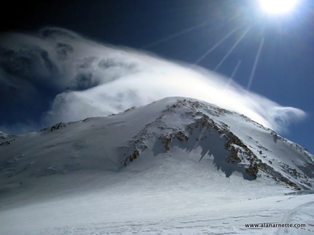
High winds on Denali preventing summit attempt

North America: Denali (20,320’/6194m) Denali is the native American name for the mountain. In 1980, in honor of President McKinley, the National Park Service named the surrounding park Denali National Park. In 2015, the mountain’s name was officially changed to Denali. It is in central Alaska – 300 miles South of the Arctic Circle and 200 miles East of the Bearing Sea. Denali offers some of the largest vertical gain of any mountain on Earth. With base camp at 7,200′ and the summit at 20,310′, this 13,110′ gain over twelve miles is larger than Cho Oyu (8,407) or even Everest (10,535). The biggest threat to Denali is the weather. It is well known for socking you in for days with high winds and snow. 45,411 climbers have attempted Denali, with 23,426 summiting, a 52% success rate. Almost 125 have died, including 11 in 1992. The second highest mountain in North America is Mt. Logan in Canada’s Yukon, at 19,551’/5959m, 385 miles southeast of Denali. Similar to Denali, Logan is a vast massif with eleven peaks. Logan is believed to have the largest base circumference of any mountain. The normal route is straightforward, but the weather is a significant problem for Logan, as it is for Denali, in addition to being so remote. Here’s a look at the summit stats for the popular West Buttress route from 2000 to 2024, along with the most popular summit day: Denali West Buttress Route source: National Park Service Year Total Summits % Top Summit Date # 2024 523 50 2023 308 30 2022 745 70 2021 490 52 2020 CLOSED FOR COVID 2019 793 65 2018 463 44 June 8 67 2017 461 41 May 31 54 2016 647 60 June 16 83 2015 589 57 June 15 87 2014 404 35 June 4 99 2013 729 68 May 27 56 2012 460 40 May 27 56 2011 623 55 May 27 & 30 45 2010 630 56 June 21 54 2009 649 60 June 7 77 2008 652 58 May 30 91 2007 513 47 June 12 77 2006 545 52 May 29 50 2005 716 59 June 15 101 2004 628 54 June 4 71 2003 556 58 June 12 115 2002 575 53 June 13 56 2001 670 60 June 4 69 2000 556 53 June 3 71 These are some quick facts from the NPS for 2024: Climbers from the USA: 639 (64% of the total of both Denali and Foraker registrants) US climbers came from all over, with representation from 46 of the 50 states, plus the District of Columbia. Consistent with past years, most US climbers came from the following four states: Washington State (95), Alaska (81), Colorado (79) and California (36). International climbers: 362 (36% of total) Denali National Park welcomed international climbers from 51 countries this year. Once again, the top was Canada (40), followed by the United Kingdom (38), Poland (20), and China, India, and Japan, each with 17. Average trip length: The average trip length (regardless of outcome) for non-guided groups was 14 days, with guided Denali climbs averaging 17 days. Isolating just the climbers who reached the summit increased the statistic to 20 days. Average age  Submission of a climber’s age is now optional when applying for a Denali permit. Based on the individuals who did disclose their age this season, the average age for male climbers was 39, while women averaged 36 years old. The youngest climber was 15, and the oldest was 75. Women climbers  Women comprised 16% of climbers on Denali and Foraker, or 161 individuals—down from 2023 when 197 women (19% of the total) attempted Denali and Foraker. Denali Resources I have climbed on Denali three times. You can read about my climbs through these links: Denali Home Denali FAQ Denali 2011 Denali 2007 Denali 2001

Orizaba

Orizaba

A trip report from climbing Mexico’s Orizaba, 8,880 feet/5,754 meters in 2008.

Denali 2007 Trip Report

Aplenglow on Denali 2011

This is a very personal, detailed and sometimes graphic report. It chronicles my attempt on Denali in June 2007. My intent is to bring readers into my world of high-altitude mountaineering by showing the incredible rewards, the obvious dangers and what happens when the human body hits the wall. Remember to click on any picture in the report to enlarge it then use the back arrow to return to the report. Denali 2007 was the first of four climbs for my return to Mt. Everest: Memories are Everything® journey. I aimed to raise $100,000 for the Cure Alzheimer’s Fund (CAF) by using the Denali, Shishapangma, Orizaba, and Everest climbs. My hope was/is to summit each peak and raise awareness and money through real-time dispatches sent directly from each Peak. I left Denver International Airport for Anchorage on June 10, 2007. With Everest in the plans, Denali was almost an afterthought for my journey – a familiar climb designed to test my body once again against the rigors of high altitude. I was there in 2001 and was turned back by poor weather at  Denali Pass or 18,200’. I was confident I could make the climb, weather permitting. My only concern was the heavy loads involved: 120 lbs split between my pack and sled that needed to be hauled up almost 2 miles purely through my strength. Hey, I am 50 years old! The week before I left, I worked closely with the CAF’s Tim and Katie to coordinate both websites to post my dispatches and receive donations marked for the Memories Are Everything® fund. My training was as good as it would be, thanks to some challenging climbs in the Colorado Mountains with my partners Patrick and Robert. Leaving Colorado, I felt confident, strong and nervous about the year-long commitment I had publicly announced. What if I failed? What if I didn’t summit this “familiar” climb? What if… I met my guides and teammates at the Alaska Mountaineering School (AMS) on June 12 in Talkeetna, Alaska. I selected AMS due to its reputation as a solid guiding company with an excellent record of safety and success and its focus on the basics. I felt this reputation would attract more competent climbers, enhance my chances of success, and, more importantly, deliver an overall positive experience. Christian March was the lead guide. A young man of 27 years, he shook my hand with an air of confidence and gave orders on what to do and how to do it. I liked him immediately. Next, I met his assistant, Leighan, an impressive 26-year-old native Alaskan who oozed with personality. She gave immediate life to the team. Soon, the other five climbers arrived at the old house AMS had converted into their offices. They were a diverse group, including a father-son pair, a banker, a tattoo studio owner and a British law enforcement officer. Most had good mountaineering experience, and all were eager to summit Denali. Thus, the team was set. Scheduled to fly out the next day, we rushed to check our gear and review some basic glacier travel skills. But the weather in June 2007 had been challenging. Colder than normal temperatures and high winds had reduced the usual 50% summit rate to a very low 33%. And it continued. Our flight to the Kahiltna Glacier was delayed for two days. We rushed to the airstrip twice to load the DeHavilland Beaver Turboprop, but we were told the flight was canceled. So we bided our time in the township of Talkeetna by doing more “classes,” as AMS calls their review of skills, and scrambling at the last minute to find a place to spend the night. We also enjoyed the sights and entertainment of the local bars and restaurants. Remember that Talkeetna has one main road – paved, that is – and is straight out of the television series Northern Exposure. It’s a great place, to be sure. Finally, we got the word on June 14th, we would be flown to the glacier. The flight is one of the best I have ever taken in my mountaineering travels. Second only to the landings at Lukla, Nepal, in the late 1990s when the landing strip was dirt with Yaks crossing it and pilots who chatted casually as the plane appeared to be on a direct collision course with the steep mountain side! But this flight, smoothly operated by Paul Roderick, the owner of Talkeetna Air Taxi, was more like a scheduled commercial flight – no wait – better. We rose to about 10,000’ over the Alaskan tundra as we approached the Alaskan range. Mounts Denali, Foraker and Hunter stood proudly above the rest of the snow-covered mountains in the range. Another plane passed by a quarter of a mile away with sightseers. I thought about the fact that their journey would end in half an hour, ours in 21 days. “500 feet,” announced the comforting female voice of the automated flight systems as we flew over a high mountain pass. Paul banked the Beaver to the right as we approached the “landing strip.” Memories of my 2001 climb came back, and I felt the adrenaline flow as we made the steep descent and abrupt landing on the hard-packed ice. I had made it back. Now, all I had to do was climb Denali and get home safely. Due to poor weather, over 200 climbers were stranded for several days. So, as the plane spun around, we saw a refugee camp of climbers with the 100-yard stare in their eyes, drooling at our tiny 8-person plane. I was slightly afraid of a rush to take it over, but the National Park Service (NPS) has Rangers at the base camp (BC) to organize flights in and out. All quite civilized, as my British friend would say. Our first order of business was to unload our gear from the airplane—a 60-lb pack each, over 500 lbs of food, three tents, stoves, fuel, and God knows

Mt. Hood

Mt. Hood

U.S. Oregon 11,237 feet 3,426 meters Trip Report July, 2004 Mt. Hood is one of several volcanoes on the west coast of the U.S. It is located fifty miles east of the city of Portland, Oregon, in the Mt. Hood National Forest near the windy town of Hood River. It is very easy to reach the trailhead since it starts at the parking lot of Timberline Lodge which is the base for the ski runs located on Hood’s southern slopes. It is common to see skiers high up on Hood. But it can also be very dangerous as evidenced by the deaths in 2002 of climbers falling into a crevasse and a helicopter rescue gone bad. In final preparation for climbing Mt. Rainier, I summited Hood in July 2004 with two friends, Bryan and Ian. We used the standard route named the Hogsback. It was a long but straightforward day. We climbed independently most of the time but roped up near the summit since the final ridge was quite exposed, and it was extremely windy that day. The previous day, we visited the Timberline Lodge to get final information and register with the Park Service. But all the offices closed at 1:30 PM so we were on our own. We got the paperwork from a self-service registration stand next to the trailhead as we left for dinner. At the Mt. Hood Inn, we spread all our gear on the lawn for a final check and a quick refresher course on crevasse rescue and rope travel. We started at 2:00 AM after a short night at the nearby Inn. The route was clearly marked with a big sign stating “Climber’s Route” and yellow discs on tall poles. It is designed to take climbers along the east side of the ski runs. The starting elevation is 5,800 feet. The steady slope rises two miles to the top of the ski runs at a 30-degree grade. The wind was picking up as we reached 8,600′. I was pretty surprised to see only two other people climbing on this day since Hood has a reputation of being crowded. It could have been the winds! As we reached a small plateau at about 9,000′ the winds were blowing a steady 30 m.p.h. with gusts to 50 and occasionally to 70. All three of us were knocked off our feet several times. Going higher seemed foolish in these conditions, and just as I was about to suggest turning back, it calmed. Well, at least it stopped gusting! As the sun came up, we were treated to the shadow of Hood off to the west. We sighted Crater Rock ahead and to our left and headed up a slightly steeper snow slope. The smell of sulfur filled the air, so I knew we were close to the Devil’s Kitchen, a caldron of steam vents. The ground became mixed with snow and rock as the warmth from the vents kept the snow away in July. I was a little slower than my friends, and given their lack of experience with rope travel (plus I had the rope) and exposure to snow ridges, they waited patiently at the base of the Hogsback about 10,600′. Looking at the ridge, it was clear we needed to rope up for safety. So on with the harnesses as I pulled the rope out of my pack. I led the relatively short climb up the ridge. A Bergshund split the ridge about halfway to the twin rock towers called the Pearly Gates. We took a path to the left to reach a narrow gap in the bergshund. Once across, we continued our climbing to the Gates. Waiting for everyone to arrive, I enjoyed the views of the Kitchen and surrounding pinnacles and ridges. This is an area for rockfall so we left our rope and quickly headed for the summit saddle. About 200′ at an aggressive angle and we were there. Once on top, the winds picked up again. It was about 9:00 AM, and it had taken seven hours to climb the 5400′. We enjoyed the views and took some pictures as well as made a quick climb to the true summit about a hundred feet away and maybe 50′ vertical. On the downclimb, we roped up again until we were at the bottom of the Hogsback. From there it was a simple matter of tracing our steps back to the parking lot. With the steep slopes, we enjoyed some glissading that sped things up quite a bit. It took us about 3 hours to return. Mt. Hood is a little more challenging than advertised, especially if the weather is poor. The route is straightforward as long as you use Crater Rock as your guiding landmark. The crevasses are grouped off the primary route but climbers have been know to “find” them during whiteouts or storms. We thoroughly enjoyed it as a warm-up for Rainier. It was good practice and a summit to boot! It was fun to see Bryan and Ian on their first “alpine” climb using crampons, ice axes, harnesses and traveling roped together. They did great! Ian was far ahead most of the time a testimony to his fitness and Bryan, not far behind Ian, demonstrated his curiosity with his wandering. We had a great time and felt ready for Rainier three days later

Denali 2001 Trip Report

Building Snow Walls on Denali

Denali is in central Alaska – 300 miles South of the Arctic Circle and 200 miles East of the Bearing Sea. In July 2001, I flew from Denver to Anchorage, drove to Talkeetna, and took a bush plane to land on the Kahiltna Glacier to begin the climb using the West Buttress route. Denali offers some of the largest vertical gain of any mountain on Earth. With base camp at 7,200′ and the summit at 20,310′, this 13,110′ gain over twelve miles is larger than Cho Oyu (8,407) or even Everest (10,535). The biggest threat with Denali is the weather. It is well known for socking you in for days with high winds and snow, and this trip was no exception. We had pristine weather until we reached the High Camp at 17,000, when a front moved in, pummeling us with high winds, cold temperatures and blizzard conditions. The National Park Service issued a rare “evacuate the upper mountain” warning just as we arrived. We stayed a few more days, hoping for a break, but it was not to be. The trip up from base camp at 7,200′ was easy and straightforward. I found the sleds not to be as big of an issue as many people said by balancing my load between the sled and my pack. We followed the normal schedule of establishing camps and caches so that we climbed high and slept low. This way, we moved about 1,000′ a day from 7,200′ to 16,200′ in about 8 days. After arriving at base camp on day 1, we set up tents, dug a 6-foot cache and prepared for a short night. Up at 3:00 AM, we packed all our gear and moved camp up the Kahiltna glacier to 7,800′. The next few days were spent moving gear by sled and pack to caches at 10,100′ up Ski Hill, then to the base of Motorcycle Hill at 13,300′ and finally around Windy Corner to 13,800. We returned to the previous camp each night before moving beyond the previous day’s cache to a higher camp. When we reached the basin camp at 14,200, everyone was in high spirits. In fact, everyone was feeling so good that we skipped a scheduled rest day and climbed the 2,000′ headwall to establish the next cache at 16,200. With the weather and our health holding, we moved camp the next day to the High Camp at 17,200. This was the longest, most difficult day thus far for most of us. Once at High Camp, some people began to feel the effects of the high altitude. Symptoms ranged from mild headaches and lethargy to severe headaches, nausea and a lack of motivation to continue. It was very disappointing, given how well everyone had been feeling. We attempted a summit bid the following day since the weather was deteriorating quickly, and we knew it may be now or never for us. We made it to Denali Pass, where we were met with gusts of 60 mph, snow and extreme cold. When Bill Allen, owner of Mountain Trip and our guide, saw a lenticular on Foraker and another forming directly above us on Denali summit, he called the climb, and we returned to High Camp. The next day, we sat outside in our tents with a blizzard howling. A few of us were prepared to attempt the summit again the next day, but with high clouds, plumes flowing from the ridge, and forecasts for more of the same, we decided to return to base and make this trip to the mountain. Upon returning down the ridge to the basin camp, I hit a spot of soft snow with my right foot and hurt my knee when I twisted between my self-arrest and crampons, catching into the loose snow. It appeared to be an ACL tear but ended up being a severe strain, and nothing was torn. My trip down the fixed lines of the headwall was slow and painful. The following day’s 7,000′ return to base camp was the longest day of the climb. I had incredible support from my teammates – thanks, guys! While coming within 2,000′ of the summit was disappointing, we had a great time, and everyone gave it their best. I was very pleased with how my body behaved once again at high altitudes, especially to the heavy loads. Before this climb, I knew I could control two critical variables: conditioning and attitude, but not the weather. In this case, two out of three were not good enough to make the summit. Next time! Denali Resources I have climbed on Denali three times. You can read about my climbs through these links: Denali Home Denali FAQ Denali 2011 Denali 2007 Denali 2001